

What Makes a Good Bike Network?
By: Rebecca Davies, City Ratings program director
PeopleForBikes’ City Ratings program measures six factors found in good bike networks captured by the acronym SPRINT.
A city’s bike network consists of all of the roads and bikeable paths that are part of the city’s transportation system. PeopleForBikes’ City Ratings program scores the quality of cities’ bike networks on a scale of 0 (poor) to 100 (excellent).
Good bike networks share characteristics with good roads for driving and good sidewalks for walking: they provide dedicated space separate from other travel modes, they are designed to maintain reasonable speeds, and they are interconnected, meaning people can seamlessly travel everywhere they need to go without running into dead ends or gaps.
Bad bike networks aren’t networks at all. They have no bike infrastructure or contain disconnected fragments of good bike infrastructure, resulting in inefficient and dangerous routes that few people use.
City Ratings measures six factors found in good bike networks: safe speeds, protected bike lanes, reallocated space, intersection treatments, network connections, and trusted data, all captured by the acronym SPRINT.
Safe Speeds
High motor vehicle speeds lead to more crashes, serious injuries, and fatalities. People riding bikes and driving can safely mix when speeds are 25 mph or less. You can explore our legislative guide to reducing traffic speeds for more information on how to achieve safe speeds in your city.
Example: San Francisco’s (City Ratings score: 64) Slow Streets program models how cities can make shared streets safer through road design that reduces travel speeds.
Protected Bike Lanes
Protected bike lanes can take many diverse forms, but all provide physical, vertical separation between people bicycling and driving. Most roads with three or more motor vehicle travel lanes or speeds above 30 mph need protected bike lanes. Cities can build protected bike lanes faster by implementing Complete Streets mandates.
Example: Explore the 20 best new protected bike lanes built in the U.S. in 2023.
Reallocated Space
Rethinking how street space is used can open a wide range of opportunities to improve a community, from adding bike infrastructure to outdoor restaurant seating and public gathering space. Check out the Urban Design Guide from the National Association of City Transportation Officials (NACTO) for recommendations on how to make the most of your city’s street space.
Example: Newton, MA (City Ratings score: 9) is reconfiguring oversized and underutilized Washington Street, which allows the city to add protected bike lanes, motor vehicle turn lanes, bus boarding platforms, crossing enhancements, trees, public art, noise mitigation, and signage.
Intersection Treatments
Good bike networks provide safe crossings. Intersection treatments that create safe crossings include stop signs, traffic signals, crosswalks with flashing lights, roundabouts, crossing islands, and shortened crossing distances. Read NACTO’s Don’t Give Up at the Intersection for strategies to improve intersection safety.
Example: Philadelphia (City Ratings score: 58) recently started construction on the Penrose Roundabout, which will improve safety and traffic flow by replacing a dangerous six-way intersection with a roundabout that includes protected bike lanes, crossing islands, and shortened crossing distances.
Network Connections
Good bike networks connect people to places they want to go. While it takes time to build a complete network, advance planning and secure funding can ensure every local infrastructure project grows the network. Find strategies to fund your city’s bike network in our legislative guide to funding bike infrastructure.
Example: Great bike plans are transforming bike networks in these nine U.S. cities.
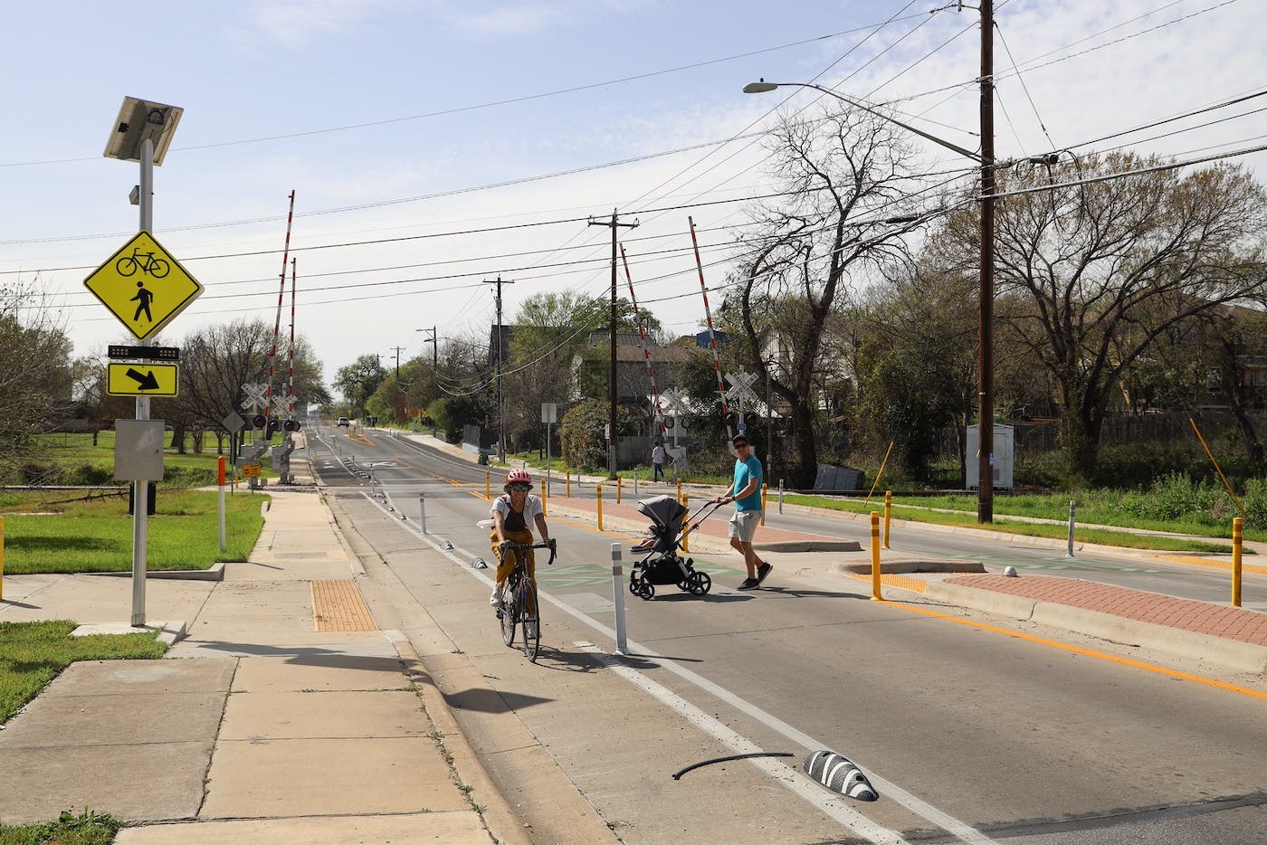
Trusted Data
A lack of quality data on bike infrastructure in many U.S. cities complicates efforts to establish bike network goals and measure progress. City Ratings relies on OpenStreetMap data to fill the gap. View our OpenStreetMap Editing Guide and OpenStreetMap Tag Guidelines to update infrastructure data for your city.
Example: Austin, TX (City Ratings score: 34) maintains detailed documentation of their city’s completed and planned bike infrastructure so they can measure progress towards meeting the city’s bike network goals.
Cities that consistently implement projects that address the SPRINT factors will see their City Ratings score rise over time through the growth and improvement of their bike network. Bike network growth will then lead to higher bike ridership, stronger communities, and greater safety for all road users.

Take Action
